Launch and measure
How can a map become a mathematical route model?
Interpreted constraints, candidate routes, coordinate distances and scale conversions.
A KSHS WSIM learning sequence using one logistics problem to connect coordinate distance, gradient, midpoint, scale, straight-line models, direct proportion and mathematical modelling.
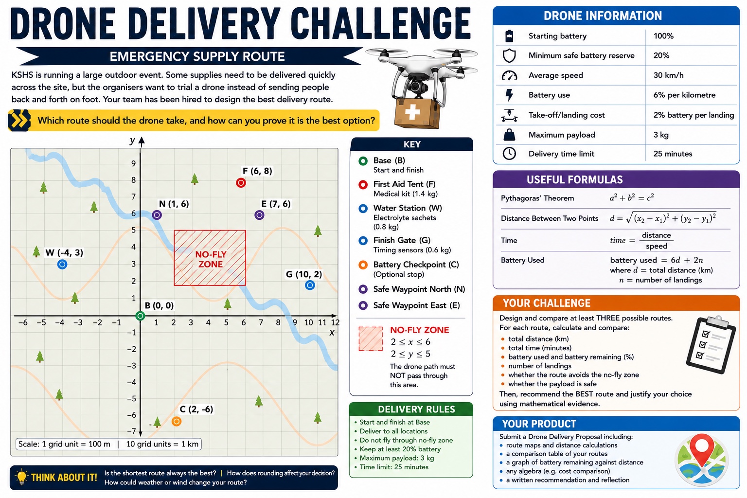
How can a map become a mathematical route model?
Interpreted constraints, candidate routes, coordinate distances and scale conversions.
How can gradient, midpoint and line equations prove a path is safe?
Coordinate evidence for route direction, checkpoints and no-fly-zone avoidance.
How do changing distance and landings affect feasibility?
Direct-proportion and straight-line models, route comparisons and careful rounding.
Which route is best—and what evidence is enough to prove it?
An individual written Drone Delivery Proposal with calculations, models and limitations.
Developed across Lessons 13–15 and submitted as an individual written product in Lesson 15
These decisions remove ambiguity while keeping assumptions visible for students to evaluate.
The unit uses the revised SCSA Western Australian Curriculum: Mathematics for implementation in 2026. Curriculum is mapped by strand, sub-strand and content description rather than legacy ACMNA/ACMMG codes.